
| Icelandic Meteorological Office
Dept. of Geophysics |
Map of the soutwest part of Iceland
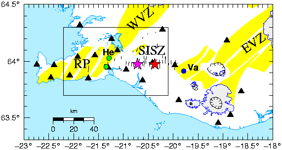
Figure 1:
Map of the southwestern part of Iceland.
The locations of the MS=6.6, June 17
and June 21, 2000 earthquakes are shown with a red
and a purple star, respectively.
The June 1998 and November 1998 earthquake epicenters in
the Hengill area (He) are shown with green dots.
The May 1987 epicenter near Vatnafjöll (Va) is shown
with a blue dot.
The locations of the
South Iceland seismic zone (SISZ), Reykjanes peninsula (RP),
western volcanic zone (WVZ) and eastern volcanic zone (EVZ)
are shown.
The black box shows the extent of the area
used in the velocity simulation.
Thin black lines denote mapped surface
faults (Einarsson and Eiriksson:1982, Einarsson and Saemundsson:1987,
Erlendsson and Einarsson:1996).
The yellow areas are volcanic fissure
swarms, and the calderas are shown with black lines with tick marks.
The locations
of SIL seismic stations are shown with black triangles.