
| Icelandic Meteorological Office
Dept. of Geophysics |
Map of the Hengill area
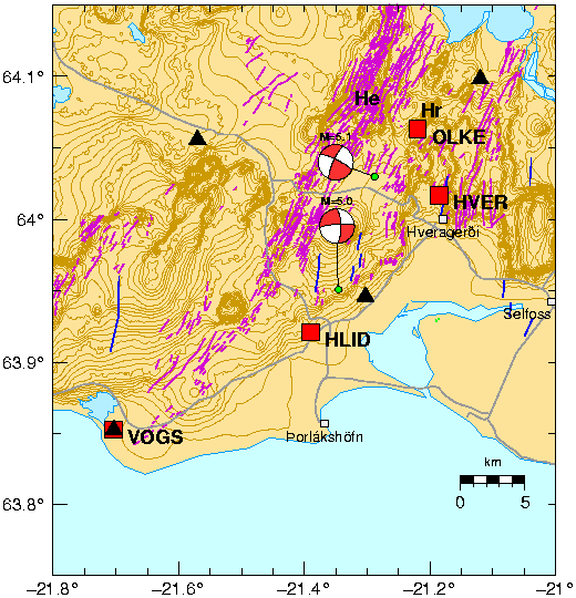
Figure 1:
Map of the Hengill triple junction in SW Iceland.
Hr is Hrómundartindur and He is Hengill.
Black triangles are SIL seismic stations.
Red squares are the ISGPS stations. Station OLKE is near Ölkelduháls.
The epicentral locations of the ML=5.1 June 1998 and
the ML=5.0 November 1998 earthquakes are shown
with green dots as well as their focal mechanisms.
Roads are shown with gray lines.
Mapped normal faults and fissures are shown with
purple lines and N-S trending strike-slip faults with blue lines
(Saemundsson, 1995; Erlendsson, 1996).