
| Icelandic Meteorological Office
Dept. of Geophysics |
Map of the Mýrdalsjökull area
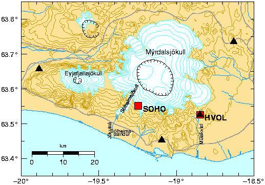
Figure 2:
Map of Mýrdals- and Eyjafjallajökull.
Red squares are continuous GPS stations,
and black triangles are SIL seismic stations.
The calderas of Katla and Eyjafjallajökull are shown on the figure
as black lines with tick marks.