Continuous GPS measurements
Composite time series figures for monitoring of crustal deformation

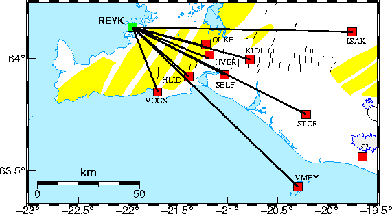
The black lines on the map above show which stations are plotted on the the graphs below.
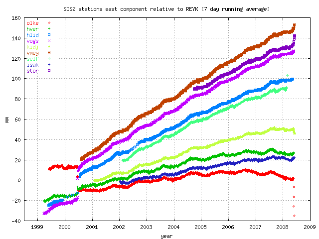
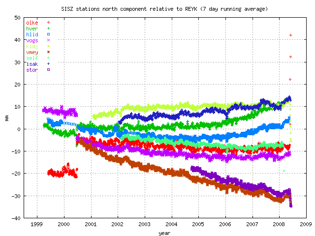
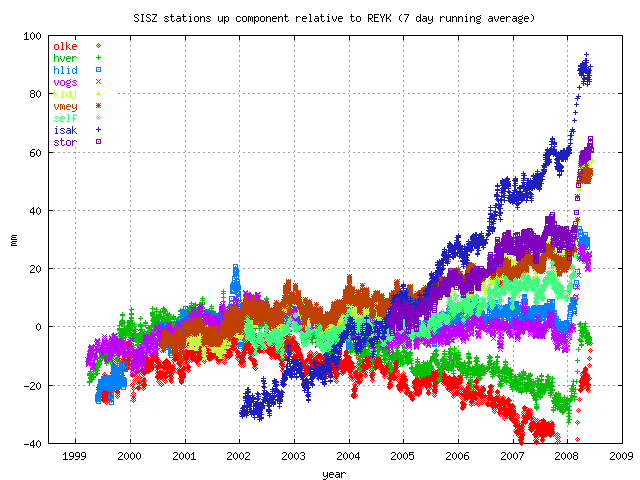
The graphs show time series (movements) for the CGPS stations OLKE, HVER, HLID, VOGS, KIDJ and
VMEY since the onset of measurements (1999) using a 7 day weighted running mean.
The top figure shows station movements in the
east component, the middle and bottom figures show the north and vertical components, respectively.
A majority of the points are from the final processing of the data (using final
orbit products), but the last 10 to 40 days are from automatic processing using
predicted satellite orbits. The graphs are updated automatically on a daily basis.
Uncertainties are not plotted, but offsets and outliers are removed before calculating
the running mean.
 East component of the stations since onset of measurements. Jumps in the time series
in mid-2000 are due to the South Iceland seismic zone earthquake sequence.

North component of the stations since onset of measurements. Jumps in the time series
in mid-2000 are due to the South Iceland seismic zone earthquake sequence.

Vertical component of the stations since onset of measurements. Jumps in the time series
at VOGS, HLID, HVER and OLKE are due to radome installation
Back to the ISGPS homepage
Halldór Geirsson (dori@vedur.is).


