Continuous GPS measurements
Composite time series figures for monitoring of crustal deformation
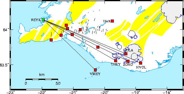
The black lines on the map above show which stations are plotted on the the graphs below.
The graphs show time series (movements) for the CGPS stations VMEY, THEY, SOHO and HVOL
since July 2000. The top figure shows station movements in the
east component, the middle and bottom figures show the north and vertical components, respectively.
A majority of the points are from the final processing of the data (using final
orbit products), but the last 10 to 40 days are from automatic processing using
predicted satellite orbits. The graphs are updated automatically on a daily basis and
thus the last point on the graphs should be from the data of yesterday.
Uncertainties are not plotted and outliers and offsets are not corrected for.
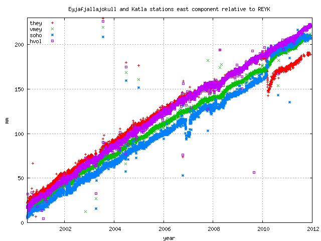 East component of the stations since July 2000.
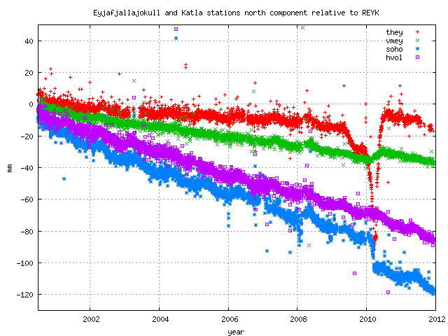
North component of the stations since July 2000.
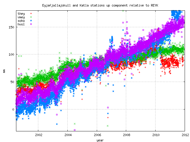
Vertical component of the stations since July 2000.
Back to the ISGPS homepage
Halld¾r Geirsson (dori@vedur.is).