
| Icelandic Meteorological Office
Dept. of Geophysics |
Peak velocity maps
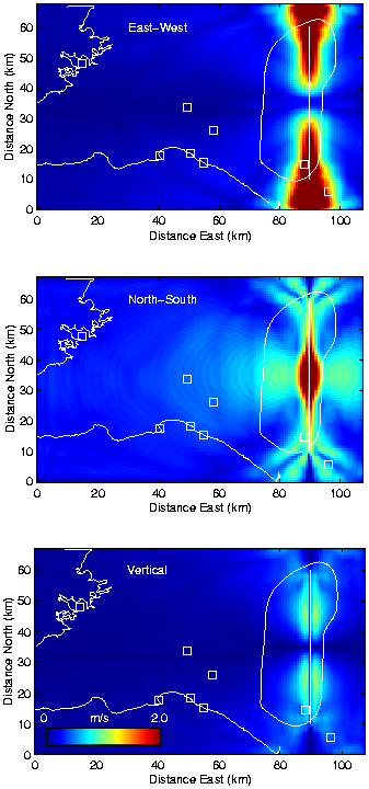
Figure 4:
Peak velocity maps for the reference model with
400 m grid spacing.
The fault is 50 km long and extends from the surface down to 15 km depth.
The slip is uniform right-lateral strike-slip.
The hypocenter is in the center of the fault at 10 km depth.
The rupture propagates radially out from the hypocenter with a
constant rupture velocity of 2.7 km/s.
The N-S line shows the surface trace of the fault model.
The squares depict current locations of towns and major villages shown in Figure
2.
The N-S elongated area corresponding to MM VIII-IX is also shown.
The color scale extends from 0 m/s (dark blue) to 2.0 m/s (red).
The top panel shows the E-W component, the center panel shows
the N-S component, and the bottom panel shows the vertical component.