Results from automatic processing using CODE predicted orbits
This page is intended for monitoring the state of the crust.
Shown are time series from automatic preliminary data processing of 24hr
data using CODE predicted orbits. The plots show changes
in position during the last 85 days for
each station and are updated once per day.
Note: These are preliminary results.
- Akureyri (AKUR),
- Árholt (ARHO),
- Grímsfjall (GFUM),
- Gođaland (GOLA),
- Brúarjökull (BRUJ),
- Hlíđardalsskóli (HLID),
- Höfn, Hornafirđi (HOFN)
- Hveragerđi (HVER),
- Láguhvolar (HVOL),
- Ísakot (ISAK),
- Kiđjaberg (KIDJ),
- Kárahnjúkar (KARV),
- Ölkelduháls (OLKE)
- Raufarhofn (RHOF)
- Sauđárháls (SAUD)
- Selfoss Airport (SELF)
- Skrokkalda (SKRO)
- Sólheimaheiđi (SOHO),
- Stórólfshvoll (STOR),
- Ţorvaldseyri (THEY)
- Vestmannaeyjar (VMEY)
- Vogsósar (VOGS),
- Or view all stations on one page..
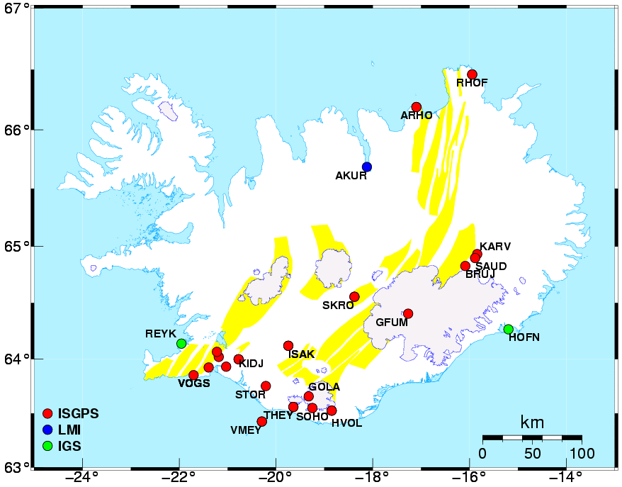
The map above shows the locations of the ISGPS sites (red circles).
IGS stations used in our
processing are shown as green circles. The blue circle in the North notes
a station operated by The National Land Survey of Iceland.
A blowup of the SW part of the network is available by clicking the SW on the map.
Back to the ISGPS homepage
Halldór Geirsson