Continuous GPS measurements in Iceland
Results from processing with final satellite orbits
Here results from the ISGPS network can be viewed. The results are in the form of
timeseries which show the displacement of a specific station east, north
and up, as a function of time.
Note these are not final results.
In alphabetical order:
- ARHO (Árholt)
- AKUR (Akureyri)
- BRUJ (Bruarjokull)
- GFUM (Grimsfjall)
- GOLA (Godaland)
- HLID (Hlíđardalsskóli),
- HOFN (Höfn, Hornafirđi)
- HVER (Hveragerđi),
- HVOL (Láguhvolar),
- ISAK (Isakot),
- KARV (Karahnjukar),
- KIDJ (Kiđjaberg),
- OLKE (Ölkelduháls)
- RHOF (Raufarhofn)
- SAUD (Saudarhals)
- SELF (Selfoss airport)
- SKRO (Skrokkalda)
- SOHO (Sólheimaheiđi),
- STOR (Storolfshvoll),
- THEY (Ţorvaldseyri)
- VMEY (Vestmannaeyjar)
- VOGS (Vogsósar),
- Or view all stations on one page.
- ...or: all stations on one page - larger figures!.
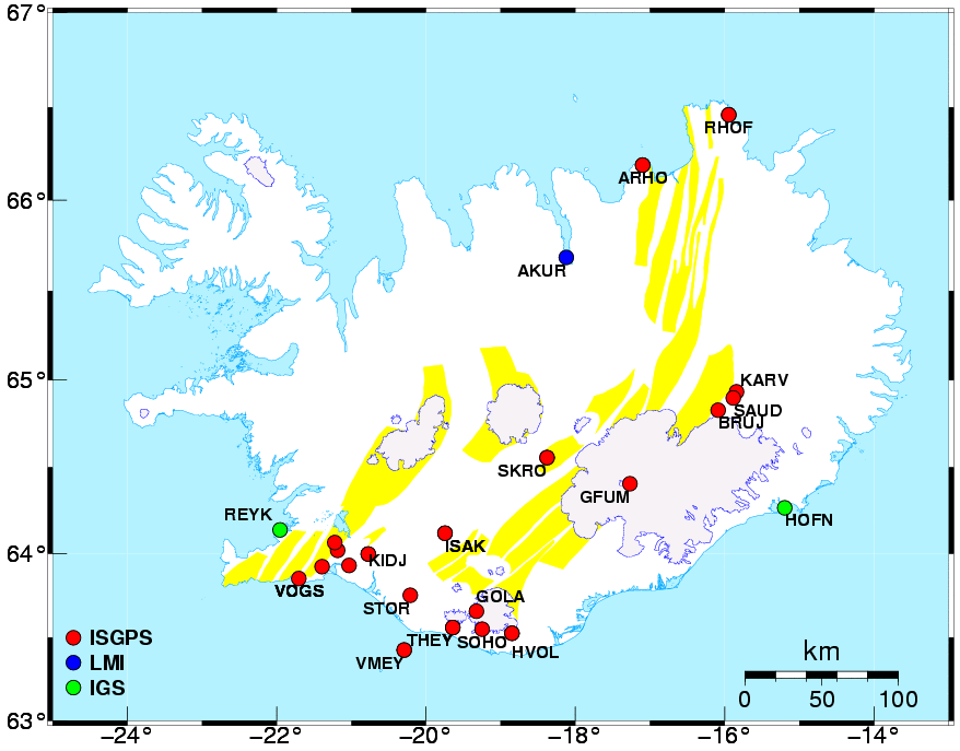
The map above shows the locations of the ISGPS sites (red circles).
IGS stations used in our
processing are shown as green circles and NLSI
stations are shown in blue.
Back to ISGPS homepage
Halldór Geirsson (dori@vedur.is).