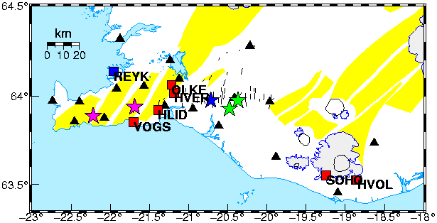
The map shows the station locations and the epicenter of the two largest earthquakes that occurred on June 17, 2000 (green stars), the two largest earthquakes on June 18, 2000 (purple stars), and the largest earthquake on June 21, 2000 (blue star). The red squares are the CGPS stations in our network. REYK, an IGS station used in the data analysis, is shown with a blue square. The black triangles are SIL seismic stations run by the Dept. of Physics at the Icelandic Meteorological Office. Plots of seismicity in the last 48 hours can be found here. The aftershocks continued along the South Iceland Seismic Zone and Reykjanes Peninsula.