Continuous GPS measurements at HLID
General information
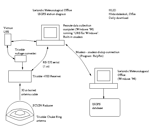
The station at HlÝdardalsskˇli started collecting data on May 21, 1999.
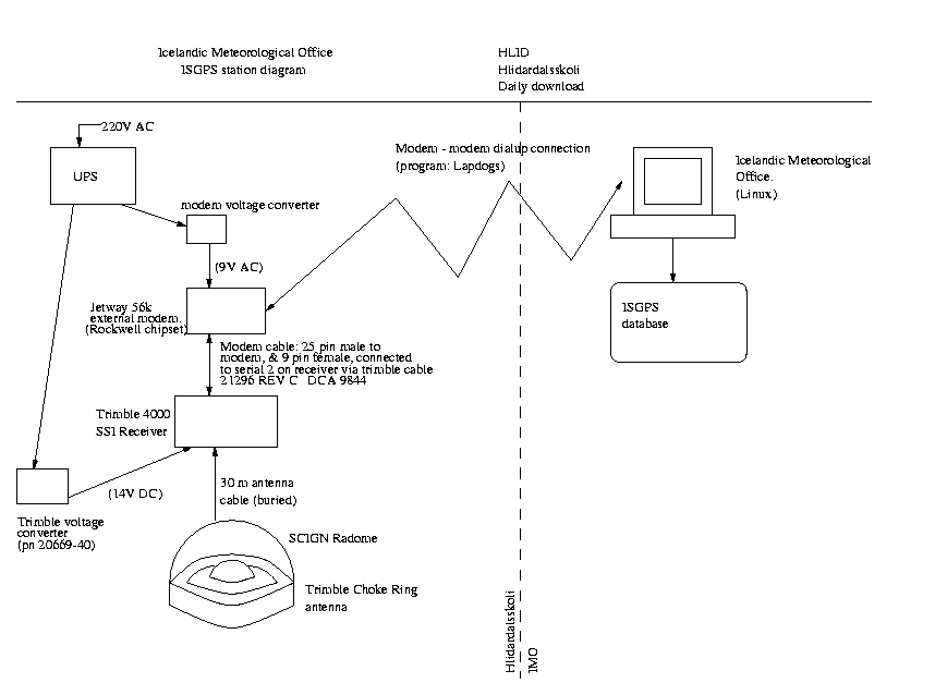
Until March 15, 2000 measurements were made using a Trimble 4700
receiver and a Trimble Choke Ring antenna. The instruments were then
removed due to snow accumulation problems and moved to THEY.
After the June earthquakes
the station has been run in a semi-continuous mode using a Trimble
4000SSI receiver.
The coordinates are:
63.92110 N, 21.38970 W, and the height above sea level is 45.5 m.
The antenna height from the benchmark to the bottom of the antenna
is now 0.9141 m. Prior to March 15, 2000, the antenna height
was 0.9089 m.
Data files:
Go to the ISGPS data page
Pictures and diagrams
Results
Displacements at HLID in east, north and vertical components (in millimeters)
assuming that REYK does not move.
Velocity at HLID in east, north and vertical coordinates (in mm/yr)
calculated from the time-series.
Back to ISGPS homepage
Halldˇr Geirsson.