Locations of CGPS sites in Iceland
In the time interval from March to May, 1999, four CGPS stations were
installed in the Hengill and Olfus area in SW Iceland.
The stations are at Hveragerdi (HVER),
Vogsosar (VOGS), Hlidardalsskoli (HLID) and
near Olkelduhals (OLKE).
Late September, 1999, measurements started at Solheimaheidi (SOHO)
just south of Myrdalsjokull glacier, which hosts the volcano Katla.
In mid - October measurements started at a new station SE of Myrdalsjokull at
Laguhvolar (HVOL). Mid - May, 2000, a site was installed
south of Eyjafjallajokull at Ţorvaldseyri (THEY),
and in July, 2000 a new station was installed in Vestmann Islands (VMEY).
Late September, 2000, measurements at Skrokkalda (SKRO)
in central Iceland started. SKRO is operated in cooperation with
LGCA in France.
In January 2001 a new station was installed at Kidjaberg (KIDJ)
in the South Iceland Seismic Zone (SISZ).
Red circles on the figure below show the locations of the ISGPS stations.
Black triangles show locations of stations in the SIL seismic network, also
operated by the Geophysics Department at IMO.
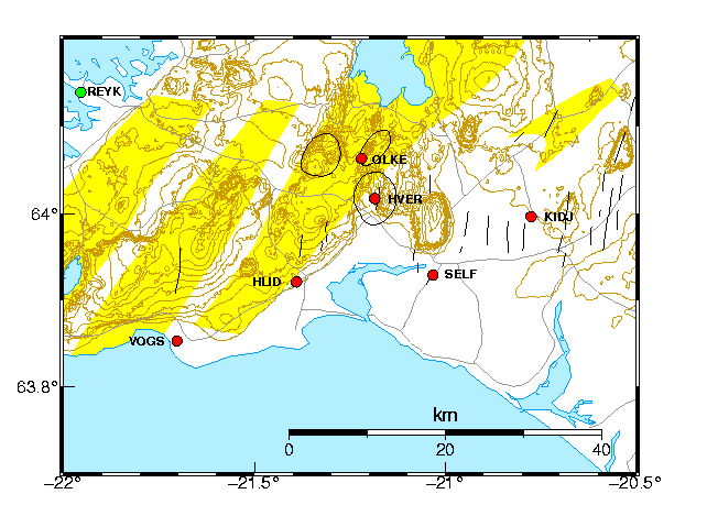
Data from the IGS stations in Reykjavik
(REYK - green square)
and Hofn (HOFN - not shown on map)
are also used in the processing. We use precise satellite orbits from the Center of Orbit
Determination in Europe (CODE) and calculate the daily station coordinates in the ITRF97
reference frame.
Movements of the ISGPS stations are calculated relative to REYK. REYK and HOFN are part
of the EUREF network.
Back to ISGPS homepage
Ţóra Árnadóttir, Halldór Geirsson.